Products
River science requires a range of technologies to manage information efficiently. These essential tasks — gathering, storing, and sharing data among collaborators — are common to most scientific efforts. Once collected, data are processed through models and analyzed to generate reports and insights that inform decision-making. Throughout this process, visualizing data and model outputs, often with maps, is crucial, as is maintaining clear communication among project teams and stakeholders.
At the Riverscapes Consortium, our primary goal is to equip river scientists and practitioners with products that let you focus on your projects, rather than reinventing these routine information management solutions for each initiative.
We design our products to be intuitive and integrate into your workflows, allowing you to assemble the tools you need for your work. In this way, our products serve as a "back office for river science," supporting your technical needs just as email and word processing software support your administrative tasks.
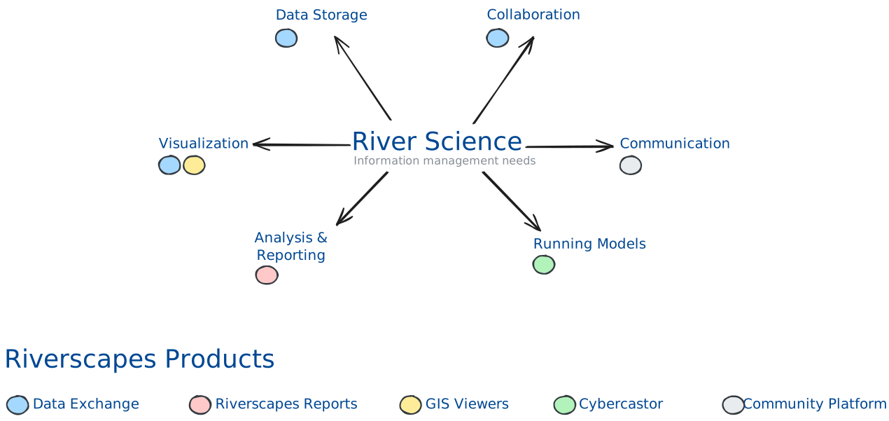
The subsections below introduce these products, as well as some additional tools. Several are intended for more technical users who want to automate or write their own scripts to leverage Riverscapes assets in their own workflows.
Cybercastor
Cloud engine for automating riverscapes models at continental scale
Data Exchange
4 items
PBR Explorer
2 items
Phlux
An application to help with repeat photography monitoring
Reports
1 item
Riverscapes Viewer
Free GIS applications for exploring any Riverscapes project, with automatic curated symbology
Command Line Interface
Riverscapes Command Line Interface (rscli)
RSXML Python Package
A Python package for authoring Riverscapes project.rs.xml files